Your cart is empty
OUR HOME, THE EARTH

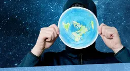
A globe is a small model of the Earth. Let's look around and get to know the planet that is our home.
This lesson aims to answer these questions.


What can be found on the surface of Earth?
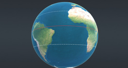
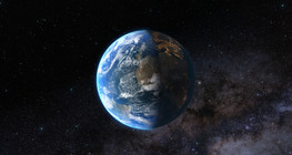
Study the following 3D scene, then answer the question: Why is the Earth is often called 'the blue planet'?


Approximately two-thirds of the surface of Earth is covered by water. The largest bodies of water are the oceans. The Pacific Ocean is the largest of them, followed by the Atlantic and the Indian Oceans. Seas are much smaller bodies of seawater, connected to the oceans.

Find the deepest point on Earth in the Pacific ocean. Read the depth and the name of the place.

Compare the ratio of the surfaces of continents and oceans on Earth using the following picture and 3D scene.

continents
oceans and seas
29%
71%
35%
21%
14.8%
8.7%
8.2%
6.0%
2.6%
2.1%
1.6%
Pacific Ocean
Atlantic Ocean
Indian Ocean
Asia
America
Africa
Antarctica
Europe
Australia


How can the Earth be represented in 2 dimensions?
Compare the shapes of the continents on the globe with the shape of the corresponding ones on the map. What do you think is the reason for the difference?
Try to make a two-dimensional drawing of the Earth.
Copy the outlines of the continents on the surface of the orange. Do not worry about being precise.
Ask an adult to help you cut the orange peel into 8 equal segments.
Remove the orange peel along the cuts.
Place a sheet of paper on the pieces of the orange peel and copy the outlines of the continents on it.
Add the missing parts. Now you can see why the shapes of the continents are distorted on maps.
Map editors work with a similar method. The more 'slices' they cut the Earth into, the more precise the representation will be.


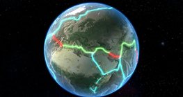
What do we know about continents?
Continents are very large landmasses. Asia is the largest continent. Physically, it is not separated from Europe to the west. These two continents together are referred to as Eurasia. The second largest continent is America. Its two main parts, North America and South America, are connected by a narrow 'land bridge'. Africa is south of Europe. Antarctica is the southernmost continent. Its surface is covered with snow and ice. The smallest continent is Australia. The numerous, small islands in the Pacific Ocean are usually referred to as Oceania and mentioned together with Australia.
Point at the continents on the world map then drag their names to the correct places.

America
Europe
Africa
Antarctica
Asia
Australia

Which is the highest peak on Earth? Find it on the map. Which mountain range is it part of? Find information on the Internet about the first people to reach the summit.

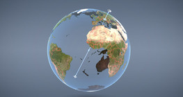
Play a continent puzzle. Copy the outlines of the continents on a transparent sheet of paper. Then glue the sheet on cardboard and cut out the continents. Now try to combine the continents into one large continent. According to scientists, this is that the ancient supercontinent might have looked like about 200 million years ago. If you want to know more about the movement of continents, open the following 3D scene.


Form six groups and choose a continent for each. Answer the following questions. Use the 3D scene entitled 'Continents and oceans' for help.
What borders the continent?
What is the size of the continent?
What is the rank of the continent among the continents of the world in terms of area?
Find the name and elevation of the highest point of the continent.

In each group, make a poster about your continent and present it to the others. The poster should include a map of the continent (you can draw it by hand), your answers to the questions, as well as some characteristic pictures.
Once all groups have presented 'their continents', do the quiz in the 'Continents and oceans' 3D scene.
Note well
A globe is a small model of the Earth.
Two-thirds of the Earth's surface is covered by oceans and seas, the rest is covered by the continents.
Oceans: Pacific Ocean, Atlantic Ocean, Indian Ocean
Continents: Asia, America, Africa, Europe, Australia, Antarctica
Test your knowledge
- Show the oceans on the world map.
- Which continents border the oceans? In which direction? Show it on the map.
- Trace the outlines of the continents on the map.
- What is the largest continent? What is the smallest?
Answer
- Which continents are contiguous?
Answer
Dry land on the surface of Earth is divided into continents which are separated by oceans.
Dry land on the surface of Earth is divided into continents which are separated by oceans.
The Earth's continents have been in constant motion during the history of the planet.
This animation presents some interesting facts in physical geography.
This lesson helps you understand what geographic coordinates are and how to use them.
The environmental issues affecting our planet are constantly worsening.


A guide about the meaning of icons found in digital lessons and the possibilities of using them.
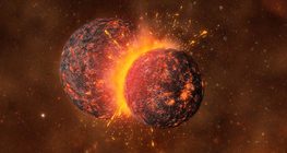
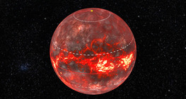
This animation demonstrates how the Earth and the Moon were formed.